- Početna stranica /
- Knjige /
- Engineering & Transportation /
- Engineering /
- Computer Modelling /
- Remote Sensing & GIS /
- Introduction to Spatial Data Analysis
0 ratings





Artikal br.:
145383070
Introduction to Spatial Data Analysis
90% of respondents would recommend this to a friend
Artikal br.:
145383070
BAM 128
Price Details
Excluding Shipping & Custom charges ( Shipping and custom charges will be calculated on checkout )
*All items will import from SAD
0 ratings
Napišite recenziju
In Stock
 Uvezeno iz USA prodavnice
QTY:
Samo 2 artikala ostalo na lageru.
Naručite sada i bit će vam dostavljeno oko Monday, oktobar 19
Secured transaction
Ubuy works hard to protect your security and privacy. Our advanced payment security system ensures confidentiality by encrypting your information during transmission using AES (Advanced Encryption Standards) and SSL (Secure Socket Layer) protocols. Your payment details are 100% secure as we do not share your payment details with third party sellers.
Our Top Logistics Partners


Fast
Shipping

Free
Return*

Secure Packaging

100% Original Products

PCI DSS Compliance

ISO 27001 Certified



Note: Step Down Voltage Transformer required for using electronics products of SAD store (110-120). Recommended power converters Kupi odmah.


Detalji o proizvodu
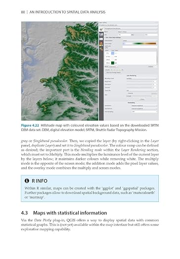
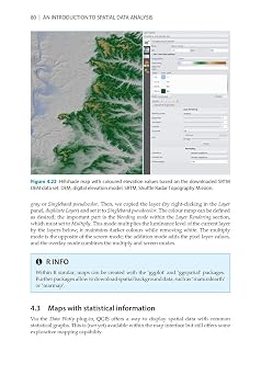
- This is a book about how environmental scientist can integrate remote sensing and GIS in their research. It will allow readers to get started with the application of remote sensing as well as GIS and to understand its potential and limitations. Using practical examples, the book covers all necessary steps from planning field campaigns to deriving relevant environmental information through remote sensing and modelling of species distributions.This book introduces spatial data handling using the open source software Quantum GIS (QGIS). In addition, readers will be guided through their first steps in the R programming language. The authors explain the fundamentals of spatial data handling and analysis, empowering the reader to turn data acquired in the field into actual spatial data. Readers will learn to process and analyse spatial data of different types and interpret the data and results. After finishing this book, readers will be able to address questions such as What is the distance to the border of the protected area?, Which points are located close to a road?, Which fraction of land cover types exist in my study area? using different software and techniques. This book is for novice spatial data users and does not assume any prior knowledge of spatial data itself or practical experience working with such data sets. Readers will likely include student and professional ecologists, geographers and any environmental scientists or practitioners who need to collect, visualize and analyse spatial data. The software used will be the widely applied open source scientific programs QGIS and R. All scripts and data sets used in the book will be provided online at book.ecosens.org. This book covers specific methods including:* what to consider before collecting in situ data* how to work with spatial data collected in situ* the difference between raster and vector data* how to acquire further vector and raster data* how to create relevant environmental information* how to combine and analyse in situ and remote sensing data* how to create useful maps for field work and presentations* how to use QGIS and R for spatial analysis* how to develop analysis scripts
| Publisher | Pelagic |
| Publication date | November 7, 2020 |
| Language | English |
| Print length | 300 pages |
| ISBN-10 | 1784272132 |
| ISBN-13 | 978-1784272135 |
| Item Weight | 1.1 pounds (500 grams) |
| Dimensions | 6.76 x 0.43 x 9.68 inches (17.2 x 1.1 x 24.6 cm) |
| Part of series | Data in the Wild |
OPIS PROIZVODA
Introduction to Spatial Data Analysis
Imate li upita? Ćaskajte s nama
Pitanja i odgovori kupaca
-
Pitanje:
Kako kupovati Introduction to Spatial Data Analysis online od Ubuya?
Odgovor: Lako je kupovati Introduction to Spatial Data Analysis online od Ubuya.. Vi samo trebate potražiti proizvod, odabrati način dostave prilikom odjavljivanja i dostaviti ga na vašu lokaciju. -
Pitanje:
Je li Introduction to Spatial Data Analysis dostupan za online kupovinu u Bosnia and Herzegovina?
Odgovor: Da, u Ubuy Bosnia and Herzegovina ovaj proizvod je dostupan za kupovinu po razumnoj cijeni.. Introduction to Spatial Data Analysis nije dostupan lokalno, ali možete nam povjeriti naše usluge ekspresne dostave. -
Pitanje:
Koliko vremena je potrebno da dobijete proizvod nakon narudžbe?
Odgovor: Vrijeme isporuke vašeg naručenog proizvoda ovisi o tome šta ste naručili i načinu dostave koji ste odabrali.. Predviđeno vrijeme dostave se spominje prilikom naplate, stoga budite bezbrižni prilikom kupovine.
Remote Sensing & GIS Editorial Review
Nije pronađena nijedna urednička recenzija
Customer Reviews & Ratings
11 ocjene korisnika
-
5 zvijezda
76%
-
4 zvijezda
0%
-
3 zvijezda
12%
-
2 zvijezda
12%
-
1 zvijezda
0%
Recenzirajte ovaj proizvod
Podijelite svoje misli sa drugim mušterijama
Customers also viewed these products
Product Price History
Važna informacija
- Ograničenja: Za proizvode koji se isporučuju na međunarodnom nivou, molimo imajte na umu da garancija proizvođača možda neće biti važeća, da opcije usluga servisiranja od strane proizvođača možda neće biti dostupne, da priručnici za proizvode, uputstva i sigurnosna upozorenja možda nisu na jezicima odredišne zemlje, da proizvodi (i prateći materijali) možda nisu dizajnirani u skladu sa standardima zemlje odredišta, specifikacijama i pravilima za označavanje i da proizvodi možda nisu u skladu sa naponom koji se koristi u zemlji odredišta i drugim električnim standardima (što bi zahtijevalo upotrebu adaptera ili pretvarača po potrebi). Primalac je odgovoran da provjeri da li se proizvod može legalno uvesti u zemlju odredišta. Kada naručuje sa Ubuy, primalac je uvoznik na formularima i mora se pridržavati svih zakona i propisa zemlje odredišta.
- Nisu svi proizvodi navedeni na Ubuy-u na prodaju jer je Ubuy globalna tražilica. Proizvodi podliježu izvozno/trgovačkim propisima.
BAM 128
Naručite sada i bit će vam dostavljeno oko Monday, oktobar 19
This item is not restrict in my country.(Please click on above link if this item is not restrict in your country, So our team will review and allow.)
QTY:
Samo 2 artikala ostalo na lageru.
Secured transaction
PCI DSS compliant and ISO 27001:2022 certified, with encrypted payments and full buyer protection on every order.
Our Top Logistics Partners
Fastest cross-border delivery
Ubuy Assurance
Experience worry-free shopping with 100% original products, PCI DSS-compliant payment security, ISO 27001-certified data protection, the fastest cross-border delivery, free returns *, and secure packaging on every order.